


Listen to the article
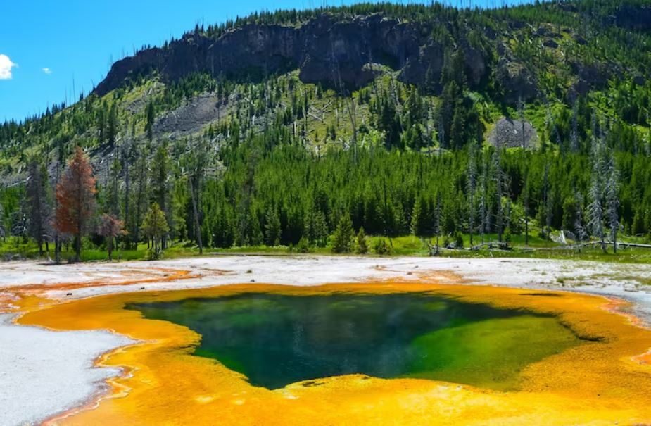
It’s difficult to imagine Yellowstone as anything but alive when you stand at the edge of the Norris Geyser Basin on a chilly Wyoming morning and watch steam curl off boiling pools and seep from earth cracks. It is breathing. It growls. Sometimes it surprises me. Thus, the response on the internet was about what one might anticipate when scientists recently confirmed that a 19-mile-wide portion of the park’s northern rim has been subtly rising since July—pushing upward about an inch, measured with the kind of precision that only GPS arrays and satellite radar can offer. Alarm. Threads of disaster. The terms “supervolcano” and “imminent” are used far too frequently together.
The bulge is real. There is no question about that. Scientists at the USGS Yellowstone Volcano Observatory are carefully and methodically debating what is causing it and how long it will last. The Norris Geyser Basin, which is already one of the park’s hottest and most unpredictable thermal zones, is close to the area in question. The Norris Uplift Anomaly is a well-known term for the current uplift. This ground has swelled before. The same area experienced a similar incident between 1996 and 2004. Prior to that, another deformation appeared and vanished without any repercussions. The scientist-in-charge of the observatory, Mike Poland, told Cowboy State Daily that the current state of affairs was “pretty stunning even if it’s not particularly unusual”—a statement that most readers of the story probably needed two readings to understand.
| Location | Yellowstone National Park, Northwest Wyoming, USA |
|---|---|
| Feature Name | Norris Uplift Anomaly (North Rim Uplift / Norris Geyser Basin area) |
| Bulge Size | ~19 miles (30 km) across — comparable in scale to the city of Chicago |
| Uplift Detected | July 2025 (current episode); previous episodes: 1996–2004, 2006 |
| Elevation Change | ~1 inch (approx. 2 cm) since July 2025 |
| Monitoring Agency | USGS Yellowstone Volcano Observatory (YVO) |
| Scientist-in-Charge | Michael Poland, Geophysicist, USGS YVO |
| Estimated Source Depth | ~9–10 miles (14–16 km) below the Earth’s surface |
| Eruption Risk | Very low — no acceleration in deformation rates; closely monitored |
| Last Major Eruption | ~640,000 years ago (caldera-forming event) |
| Annual Earthquakes (avg.) | 1,500–2,500 per year (only 1,119 recorded in 2025 — a calm year) |
| Monitoring Tools | 17 GPS stations, InSAR satellite radar, seismographs |
| Further Reading | Popular Science — Environment |
According to Poland’s working theory, magmatic fluids accumulate and withdraw about nine miles below the surface. Not lava rushing in the direction of a vent. not the accumulation of pressure prior to an eruption. Just the material that has been shifting beneath this terrain for thousands of years, moving slowly and restlessly. Yellowstone’s magma chamber currently contains a comparatively small amount of molten rock, according to a 2025 USGS study. This is sufficient to support some subterranean dynamics, but not the kind of numbers that indicate a catastrophic event is building up. “The source of this is 10 miles deep,” Poland said to a Montana CBS affiliate. “There’s a lot of rock between there and the surface, but it still has the energy to push the surface up — even if it’s only about an inch.” That observation has an almost humble quality. Something that defies the drama that the internet is so eager to assign.
The numbers tell their own story, so it’s worth taking a moment to sit with them. Every year, Yellowstone usually experiences between 1,500 and 2,500 minor earthquakes. That number was only 1,119 in 2025, making it the park’s most seismically quiet year in recent memory. While the ground may be rising in one area, the system as a whole is remarkably calm by most standards. When the word “bulge” is used in a headline with the word “Yellowstone,” that context is often lost. When the alternative is a viral disaster thread, social media is not particularly interested in nuance, and the association is too strong and cinematic.
Of course, there is a pattern here. Animal-migration footage of bison trotting out of the park in 2014 momentarily became proof of impending disaster. The 2006 version of this same uplift, which occurred when a dome roughly 25 miles across rose five inches between 1997 and 2003, caused its own wave of alarm and ultimately resulted in a Discovery Channel TV movie that likely had a greater influence on public opinion of Yellowstone’s geology than any peer-reviewed paper. Since then, scientists have been catching up to that cultural moment. It’s possible that no amount of deliberate, measured communication will be able to completely separate the true meaning of a supervolcano from what Hollywood and clickbait have made it mean.
An increasingly fascinating picture of Yellowstone’s subterranean plumbing system is made possible by the monitoring data. Interferometric synthetic aperture radar, a satellite-based instrument that can detect centimeter-scale surface movements over large areas, in conjunction with the observatory’s network of 17 GPS stations, has allowed geologists to see things that no prior generation could. “We can see things that are moving up and away from this area of uplift on radar maps and satellites,” Poland said. The patterns of deformation are not consistent. They cause ripples. They tilt. They show where the pressure is coming from and where it isn’t, and as of right now, they don’t appear to be developing into an eruption.
The deformation would be shallower, faster, and accompanied by significantly increased seismic activity if an actual eruption were on the horizon. Today, none of those circumstances exist. Poland has observed that deformation rates would need to accelerate significantly prior to any hazardous event, which the continuous GPS network would detect with a significant lead time. Lead time could be decades. The notion that Yellowstone is in some way “overdue”—a claim that consistently surfaces whenever the park makes headlines—reflects a basic misconception about how volcanic systems function. The majority of supervolcanoes do not experience multiple supereruptions, according to the USGS. The largest event in Yellowstone, which occurred 2.1 million years ago, might very well be the kind of thing that occurs once in a system’s lifetime.
As you watch all of this happen, you get the impression that the bulge isn’t the true story at all. It’s the amazing apparatus that’s being utilized to comprehend it. The ability of scientists to identify an inch of uplift over a 19-mile stretch of wilderness and start characterizing its source, depth, and likely mechanism speaks volumes about the state of geophysical monitoring. Whether this current episode will continue for months or years, or if it will quietly end like its predecessors did, is still up in the air. It appears obvious that Yellowstone will continue to be Yellowstone—restless, amazing, and utterly unaffected by the timelines that humans attempt to force upon it.


